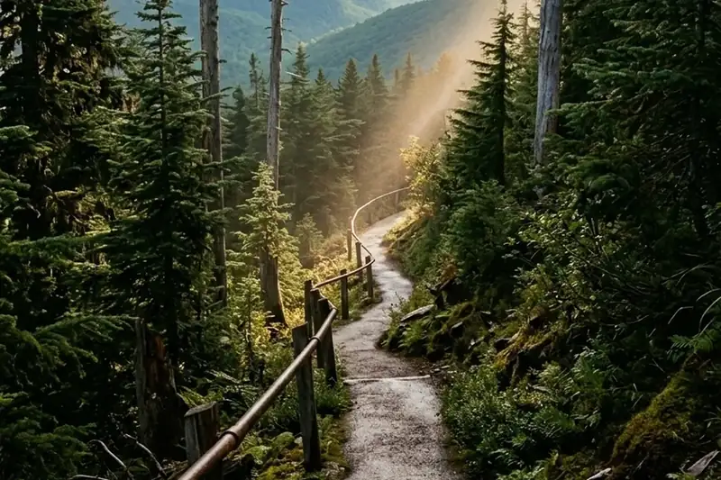
Kuwohi is the highest point in the Smokies, and the half-mile up humbles people 🏔️
Kuwohi, the 6,643-foot peak most maps still label Clingmans Dome, is the highest point in the Smokies, and the paved half-mile to the tower is no stroll.
We have watched this happen from the parking lot more than once. A family gets out of the car, looks at the sign that says half a mile, looks at the smooth pavement, and leaves the water bottles in the cupholder. Four hundred yards later they are stopped at one of the benches doing the math on whether the view is worth it. It is. But the pavement is the single most misleading thing about this hike, and almost every guide buries that under a photo of the tower.
The name is the second thing people get wrong, and it is worth getting right. In September 2024 the US Board on Geographic Names voted unanimously to restore the mountain’s Cherokee name, following a grassroots effort led by members of the Eastern Band of Cherokee Indians, whose land abuts the park boundary in North Carolina. Kuwohi means “mulberry place” and is pronounced koo-WHOA-hee. The name it replaced had honored Thomas Clingman, who was surveying these mountains in the 1850s and later became a Confederate brigadier general. The peak is a sacred place in Cherokee tradition, a refuge for people evading forced removal on the Trail of Tears in the 1830s, and a destination for medicine people seeking guidance. Nobody is entirely sure where the mulberry reference comes from, since mulberry trees are not known to grow above about 3,500 feet.
Here is everything we tell guests before they point the car up Newfound Gap Road.
Getting there: the road, the drive, and the parking tag
The road is seasonal, and the dates are firm
Kuwohi Road, which older signs and half the internet still call Clingmans Dome Road, is open April 1 through November 29 in 2026. It closes for the winter after that, and it can close on short notice any time of year for snow, ice, or hazardous weather. This is the detail that ruins the most trips. People drive up in late December expecting a gate to be open because the weather down in the valley is fine, and they find it chained.
The road itself is a seven-mile, two-lane paved spur that leaves Newfound Gap Road at the Newfound Gap parking area and climbs to the visitor contact station and overlook at the top. There are several pullouts along the way that are worth stopping at, and a couple of stretches with real drop-offs if ledges bother you. When the road is gated in winter you are allowed to walk it, but understand what that means: seven miles each way, uphill, in the coldest and windiest conditions in the park.
Give it more time than the mileage suggests
From our side of the county you are looking at the better part of an hour and a half each way once you clear the Parkway traffic. Newfound Gap Road climbs roughly sixteen miles from the Gatlinburg park entrance to Newfound Gap, and it is a slow, curving sixteen miles behind RVs and brake-tapping rental cars. Then you add the seven-mile spur. Nobody does this as a quick errand. Block out half a day.
You need a parking tag
A parking tag is required to park anywhere in the Smokies for more than fifteen minutes. Rates are $5 daily, $15 for up to seven days, and $40 annual. Annual tags come from Smokies Life online; daily and weekly tags are available on recreation.gov or by credit card at more than thirty kiosks in parking lots around the park. Buy it before you are standing at the kiosk in a line of people who did not know. If you are here for a week, the $15 tag is the obvious buy.
Parking is the real bottleneck
The Park Service does not soften this. Its own page for the hike opens with a line about expecting extreme crowding and limited parking, and the area page tells visitors to come with an alternative destination in mind. The lot fills. On a clear October Saturday it fills early and stays full, and people start creating parking spots that are not parking spots. Park with all four wheels out of the roadway or come back another day.
If you would rather not fight it, shuttles run from Gatlinburg. Taylor Made Transportation runs Gatlinburg to Kuwohi for about $25 per person (865-206-0757). A Walk in the Woods (865-436-8283) and Smoky Rides both run hiker shuttles from downtown Gatlinburg to trailheads, and both want advance reservations. Note that most hiker shuttles are one-way bookings, so you are arranging two trips, not one.
What is at the top
Pit toilets near the parking lot, closed in winter. A small visitor contact station and store. And the tower, which is worth a paragraph of its own.
The part everyone gets wrong
Paved does not mean easy. The path to the tower is half a mile one way, one mile roundtrip, and it is steep the entire way. The Park Service’s own accessibility note reads, in full, “Trail is paved but very steep.” Wheelchairs and bicycles are not permitted on it, because gravity on that grade is a genuine hazard. Wear real shoes. The descent is harder on knees than the climb is on lungs.
The view is a lottery, and you can check the odds before you leave. On the clearest days the view runs past 100 miles. Air pollution routinely cuts it to under 20. Add cloud: the summit sits in cloud a substantial share of the year, and a bluebird morning in Gatlinburg tells you nothing about conditions 5,000 feet higher. Check the high-elevation forecast, not the town forecast, and if the summit is socked in, go somewhere else and come back. If you want the seasonal odds laid out month by month, we went through them in our guide to the best time to visit the Smoky Mountains.
Dress for a different mountain than the one you left. The summit is cool and wet enough that the spruce-fir forest up there behaves like a coniferous rainforest. It is routinely far colder and much windier than the valley, in July as much as November. Bring a jacket you would not think you need. The number of people who make that climb in shorts and a tank top and then stand shivering on the platform for ninety seconds instead of twenty minutes is high.
Those grey dead trees are not fire damage. Visitors ask about this constantly. The bare, silvered Fraser firs across the summit were killed by the balsam woolly adelgid, a non-native insect introduced on imported nursery stock, which the firs have almost no defense against. It is one of the more sobering things to stand in the middle of.
There is a way around the crowd at the top. Most people never notice the bypass trail, which starts at the Forney Ridge Trailhead at the far end of the lot and climbs toward the Appalachian Trail before joining the summit path. It is the same destination with a fraction of the foot traffic, and it gives you views toward Sugarland Mountain and the Elkmont area on the way. If you want more than an hour up there, Andrews Bald is 3.6 miles roundtrip from the same parking lot and lands you on the park’s highest grassy bald, which is a very different kind of view than the tower gives you.
Leave the dog at home. Only two trails in the entire park allow pets, the Gatlinburg Trail and the Oconaluftee River Trail, and this is not one of them. Dogs are fine in the parking lot, picnic areas, and campgrounds.
What we send guests, and when
We are a Miami couple who ended up with a cabin in Sevierville, a dog who came with us, and a habit of getting up for sunrise that has not worn off. Kuwohi was the first place in the park that genuinely rearranged how we thought about this landscape, mostly because of what the mountain is rather than how high it is. Standing on a platform where the Appalachian Trail and the Mountains-to-Sea Trail both pass within a few hundred feet, on ground the Cherokee held sacred long before any of the roads existed, is a different experience than a scenic overlook.
Our honest advice to guests who book Sunny Sierra Cabin and ask about it: go on a weekday, leave by seven, check the summit forecast the night before, and have Newfound Gap or Cades Cove in your back pocket for the morning the lot is full or the cloud will not lift. Treat it as a half-day with a real chance of being weathered out, and it goes well. Treat it as a stop between two other things and it goes badly.
Late September and October are the most beautiful and the most crowded weeks up there by a wide margin. If you are aiming for color, our leaf season guide walks through how the color moves down the elevations, because the high country turns weeks before the valley does.
Quick answers
- How long is the hike? One mile roundtrip, half a mile each way, paved and steep the whole way. Most people take 45 to 60 minutes with time at the top.
- When is Kuwohi Road open? April 1 to November 29 in 2026, with weather closures possible any time.
- How high is it? 6,643 feet, the highest point in the park and the third-highest peak east of the Mississippi.
- Do I need a reservation? No. You need a parking tag: $5 daily, $15 weekly, $40 annual.
- What is the tower? A 1959 observation tower designed by the Gatlinburg firm of Hubert Bebb and Raymond Olson, with a spiral ramp running about 375 feet up to a platform roughly 45 feet above the summit. It was built in the Mission 66 era, was considered ugly and out of place by critics at the time, and is now on the National Register of Historic Places.
- Best time of day? Early. The lot is manageable before 9 a.m., and morning air is generally clearer than afternoon haze.
- Is there anything up there if the tower is fogged in? Yes, and it is underrated. Fog moving through dead firs at 6,600 feet is worth the drive on its own.
The mountain does not owe anyone a view, which is the thing to make peace with before you drive up. Go early, bring the jacket, and give yourself permission to turn around and come back another morning. The days it does cooperate are the ones people talk about for years.
Sources
- Hike to Kuwohi — National Park Service
- Kuwohi & Newfound Gap Area — National Park Service
- Seasonal Road Schedule — Great Smoky Mountains National Park
- Ancient Name Returns to Smokies’ Highest Peak — National Park Service
- Fees & Passes — Great Smoky Mountains National Park
- Surprising Things You Should Know Before Hiking Kuwohi — TheSmokies.com