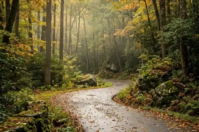
A 5.5-mile loop that hides in plain sight above Gatlinburg 🍂
The Roaring Fork Motor Nature Trail is a one-way 5.5-mile loop just outside Gatlinburg, and most of what goes wrong on it goes wrong before you turn in. It is the closest piece of Great Smoky Mountains National Park to the Parkway, close enough that people find it by accident while looking for somewhere to park, and yet it gets a fraction of the attention the Cades Cove loop road pulls. That mismatch is the whole story of this road.
We host at a cabin about forty minutes north of the entrance, and this is the drive we recommend more than any other, with the most caveats attached. Guests come back either delighted or faintly confused, and the difference almost never comes down to luck. It comes down to four things: what time they went, whether they bought a parking tag first, whether they understood the road is a commitment rather than a loop they can bail out of, and whether anyone told them what the drive is actually for.
Because here is the thing the name gets wrong. “Motor Nature Trail” sounds like a scenic overlook drive. It is not. There are essentially no big panoramic mountain views on Roaring Fork. What there is instead is a tunnel of old-growth forest, a loud stream running beside you most of the way, three preserved mountain homesteads you can walk into, a waterfall you can stand behind, and another waterfall that pours down a rock wall two feet from your bumper. It is an intimate drive, not a big one. Go expecting the Blue Ridge Parkway and you will be underwhelmed. Go expecting to slow down to fifteen miles an hour for ninety minutes and you will love it.
What’s actually on the drive, in order
Give yourself an hour and a half if you plan to stop, two if you want to hike. The whole route starts in downtown Gatlinburg at traffic light #8, where you turn onto Historic Nature Trail Road (locals and old signs still call it Airport Road) and follow it up to the park’s Cherokee Orchard entrance.
Before the loop: Noah “Bud” Ogle Place
About two miles up, on the right, there is a small lot and a self-guiding nature trail through Bud Ogle’s farmstead. Most people blow past it because it comes before the “real” drive starts. Don’t. Ogle built the place in the late 1880s and early 1890s, and three structures survive: a saddlebag cabin (two cabins sharing one central chimney, a fairly rare design around here), a four-pen barn that is the only one of its kind still standing anywhere in the park, and a tub mill from around 1885 that ran on water piped down an eighty-foot wooden flume from LeConte Creek. The flume is the part that gets people. It is a gravity-fed water system built by a farmer with hand tools, still sitting in the woods.
Rainbow Falls Trailhead: your last restroom
Just past Ogle’s place is the Rainbow Falls parking area, 48 spaces, and pit toilets. These are the last restrooms before the one-way loop. The National Park Service says this outright on its own Grotto Falls page, and it is the single most useful sentence on the internet about this drive. Rainbow Falls itself is a 5.4-mile round-trip hike and moderately strenuous, so most people are here for the parking lot rather than the trail.
The loop entrance
Just beyond the second Rainbow Falls lot, the one-way Roaring Fork Motor Nature Trail peels off to the right. From this point you are committed for 5.5 miles. No turnarounds, no shortcuts, spotty cell service, and a narrow road the park describes as “very steep.”
Two miles in: Grotto Falls and the llamas
The Trillium Gap Trailhead sits about two miles into the loop, and it is the jumping-off point for Grotto Falls, a 2.6-mile round-trip walk to the only waterfall in the park you can hike behind. It is also the resupply route for LeConte Lodge, which means a pack train of llamas comes up this trail several mornings a week from roughly March through November. Guests who meet them on the trail talk about it for years.
Now the number that decides your whole morning: Trillium Gap Trailhead has 17 parking spaces. Seventeen, in the most visited national park in the country. The Park Service itself recommends taking a shuttle or picking an alternate hike, and there are several easy hikes near Gatlinburg with far better odds of a space. If the lot is full when you roll up, keep driving, because there is nowhere to wait and nowhere to turn around.
The homesteads: Jim Bales, Ephraim Bales, Alfred Reagan
Three stops in quick succession, and they are better than they sound. Jim Bales Place has the original corn crib and barn plus the Alex Cole cabin, moved here from the Sugarlands and built around 1850. A little further on is Ephraim Bales Place, a dog-trot cabin, meaning two log pens joined by an open breezeway under one roof. Ephraim and his wife Minerva raised nine children in it on 72 acres, of which they could farm about 30, from roughly 1890 to 1930. Stand in the breezeway, count the rooms, then do that math again.
Below it is the Alfred Reagan Place, easy to spot because it is the only painted house on the drive. Reagan built his tub mill on LeConte Creek in 1895 and worked as a farmer, blacksmith, shopkeeper, preacher and carpenter, which tells you most of what you need to know about the economics of this valley.
The last mile: Place of a Thousand Drips
Near the end of the loop, water comes down a mossy rock face directly beside the road. After heavy rain it is genuinely spectacular. In a dry August it is a trickle and people drive past it without realizing it was the thing. The pull-off is small and on the right, so slow down early.
The part everyone gets wrong
You cannot buy a parking tag up here. The park’s own Roaring Fork page says parking tags “may not be purchased in this area.” Tags are required for any vehicle parked more than 15 minutes anywhere in the Smokies, and they run $5 daily, $15 weekly, $40 annual. Buy one before you leave town, online through recreation.gov or Smokies Life, or in person at a visitor center. Digital copies are not accepted, so you need the physical tag on your dashboard. This is the mistake we field the most texts about.
The road is closed for a good chunk of the year. For 2026 the season runs April 17 through November 29. If you are here in January, Roaring Fork is gated and no amount of good weather changes that. Cherokee Orchard Road and the Ogle place stay reachable, but the loop does not.
Buses, trailers, motorhomes, and vans longer than 25 feet are prohibited. If you rented an RV, leave it. People discover this at the gate, with a line of cars behind them, and it is a bad afternoon.
Timing is the whole game. Weekday mornings before nine are a different road than Saturday afternoons in October, when the loop turns into a single-file crawl and every pull-off is taken. If you are timing a trip around color, our guide to when leaf season peaks in the Smoky Mountains breaks the windows down by elevation. This applies double during the Fall Rod Run at the LeConte Center in Pigeon Forge, September 17 through 19 this year, when the Parkway backs up for three straight days and everything within ten miles inherits the traffic. Note too that the park’s free entrance days, including Constitution Day on September 17, waive the parking tag requirement and reliably bring a crowd.
Bring an alternate plan. The Park Service says flatly that demand for parking often exceeds capacity here and asks visitors to arrive with a second destination in mind. Take that seriously rather than as boilerplate.
How we send our guests up
We are Eddie and Ariana. We are a Miami couple who ended up with a cabin in the Smokies, kept the dog, and developed an unreasonable attachment to mountain sunrises. Our standing advice to guests who book Sunny Sierra Cabin and ask about Roaring Fork is the same every time: leave early, stop for a real breakfast on the way, and treat it as a morning rather than an errand you squeeze in before Dollywood.
Practically, that means out the door around seven, parking tag already on the dash, coffee in the car. Stop at Bud Ogle’s place first while the light is still coming through sideways. Then decide at Trillium Gap based on what the lot looks like, not on what you planned. If you get a space, hike Grotto Falls. If you don’t, keep rolling, enjoy the homesteads, and come back for the waterfall on a weekday. Pick up the auto-tour booklet at a visitor center if you want the stop-by-stop version, since there is no cell signal to look things up once you are in the trees.
Quick answers
- How long does the Roaring Fork Motor Nature Trail take? Budget 60 to 90 minutes for the drive with stops, closer to two and a half hours if you hike Grotto Falls.
- Is it paved? Yes, but narrow, winding and steep, with blind curves. Fifteen to twenty miles an hour is the honest pace.
- Do I need a parking tag just to drive it? Only if you park for more than 15 minutes, which you almost certainly will. Buy it before you arrive.
- Can I bring my dog? On the drive, yes. On the trails, no. Only the Gatlinburg Trail and the Oconaluftee River Trail allow pets.
- When is it open? April 17 to November 29 in 2026, weather permitting. Check the park’s seasonal road page before you go.
- Best time of day? Early morning, especially midweek. Fog in the valley is a feature, not a problem.
- Is it worth it in the rain? Arguably the best conditions on this particular road. Place of a Thousand Drips needs water to earn its name.
Roaring Fork rewards the people who slow down for it and quietly punishes the ones treating it as a shortcut to a photo. Go on a weekday morning, with a tag on your dash and nowhere else to be by ten.